
Last Updated on 1 April, 2024
Beast of Bermuda Maps – Ancestral Plains Map, Rival Shores Map, Forest Island Map and Titania Map – Maps with legend and Points of interest
Contents
Click on any of the maps to enlarge them
Other Beasts of Bermuda Guides: Cheats & Console Commands
Beast of Bermuda Maps – Ancestral Plains Map
The largest playable map at the moment is Ancestral Plains. It has a sizable ocean as well as numerous explorable terrains and monuments. The map is now the most often utilized on both official and community-run servers, therefore it’s critical to know where you’re going. Before starting a voyage as a terrestrial or aquatic species, it is advised that players who are new to the game or this map utilize a Pteranodon to fly around and acquire a sense of the area.
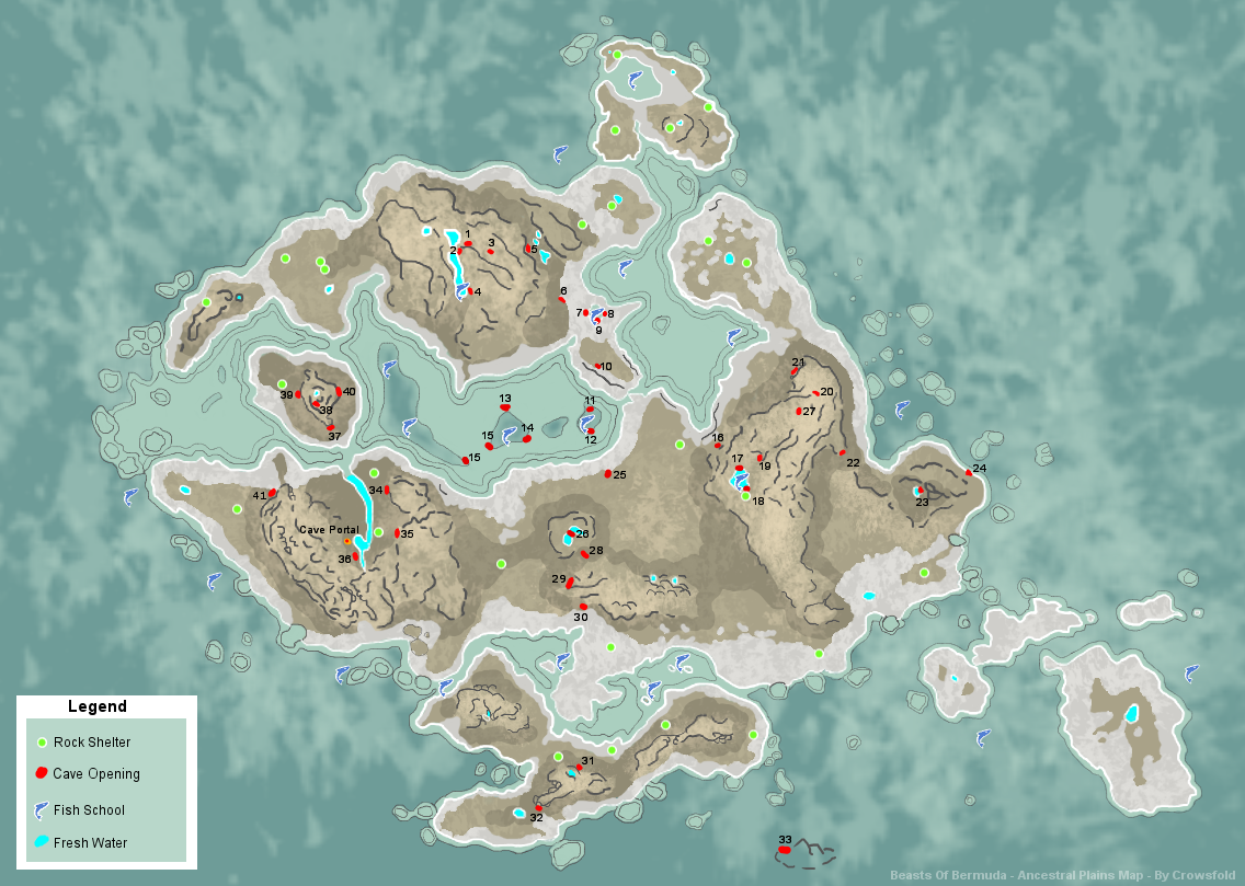
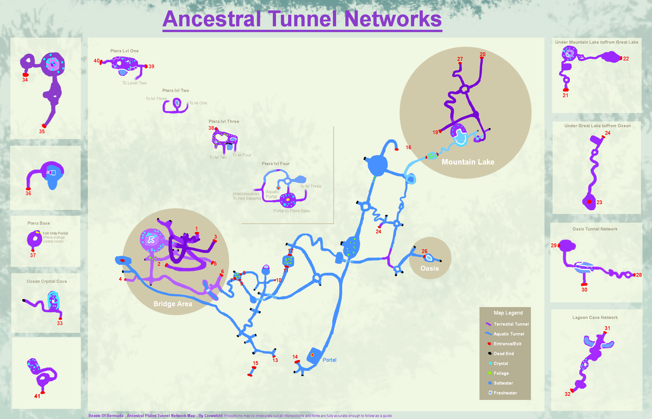
The Ancestral Plains map for Beasts of Bermuda shows the tunnels, caves, and networks therein. Possibly not the most attractive, but it works. All crossroads and forks in the road are accurate and can be used as a guide to help you go where you want to go while proportions and curves may not be. Freshwater, fish, and rock caves are also on display.
Beast of Bermuda Maps – Rival Shores Map
Rival Shores, which is a little bit smaller than Ancestral Plains, has a number of enormous, diversified islands with various biomes. The temperate forest, desert, snowy tundra, dense jungle, and typical tropical semi-forest are some of these biomes. More distinctive biomes might be introduced in the future as the map is still being constantly created. Rival Shores, like all the other maps now in use, has a sizable ocean that is ideal for aquatic life. The islands are divided by this ocean, but only at high tide. Landbridges appear between the largest of the islands at low tide.

Beast of Bermuda Maps – Forest Island Map
An extremely old map called Forest Island was taken down before the year ended 2018. It had two enormous islands that were encircled by water and further divided by a sizable internal sea. There were two smaller islands in this water where certain species could thrive. The ends of the chart showed numerous other little islets in the ocean. There were lakes, forests, meadows, dungeons, temples, coral reefs, tunnels (including underwater caves), and cliffs where Pteranodons might live. A swamp was the final biome to be included.

Titania Map
The Titania Map will be added soon

Leave a Reply